Sunday, November 20, 2016

Carlyle Lake Ghost Mountain camp out 11/18/16

My nephew Andon and I got moving around 9 am after having breakfast and arriving at the Lake Abitibi access road around 10 am. We cut some dead standing black poplar and birch to make life a little easier in the evening and made our way to Carlyle Lake road. The road was a little more narrow than I had remembered and my paint on the truck was none-too-impressed but we otherwise made it without any issues. We parked in the little campsite cut out and proceeded to set up the arctic 5 man bell tent and set up the woodstove and cots.


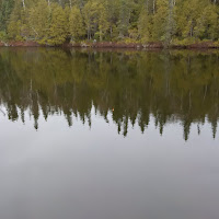
Once we were set up we walked down the road to Carlyle to do what we came to do : fish. The road was a lot muddier than when I came down in the May but we managed to keep fairly dry. Carlyle lake is a beautiful sight nestled in the middle of Ghost range and is surrounded by bluffs and mature growth forest, countless giant cedars and spruce dot the cliffs around the lake,the water is crystal clear and the bottom is mixed sand and boulder. The MNRF stock the lake fairly religiously with brook trout
   
             <---this from="" is="" may="" p="" photo="">
We fished for about a few hours and we caught several small trout that weren't keeper sized but I managed to catch one that was good for the pan.
The keeper after cleaning
 Andon hard at work

 One of the little guys
Bobbers and worms and spinners.
A large snow storm was expected in the region so our two day trip was already cut down to one, but we were monitoring the weather channel on my VX-7R in case the outlook got better or worse.
We left the lake around 3pm and cooked an early dinner of brook trout and backpacker spaghetti. By the time dinner was done it was well on the way to getting dark.

We went back to the tent unrolled our bedrolls and started up the wood stove, we spent the evening cracking jokes and listening to the radio stations in the area.I was awoken around 1:30 am by the tent shuddering and massive winds and loud booms getting closer, a November thunderstorm. For a tent that has little waterproofing and made in the 50s it held it's own very well with the only major issues being hot water running down the stove pipe and under the doorway. The rain continued through the night and the rest of the next day.

 The tent can get very balmy with the woodstove rolling so it takes a little while to get used to using the flue and damper.


The next morning we went out fishing but only managed a little guy. So we went back to camp and dried off and started packing up. By noon all was packed up except the water logged tent which I rolled up in one heck of a sodden mess inside of a tarp. The return drive was fairly uneventful and the snow only started to really come down when we arrived in Timmins. 
Now for the long process of drying and cleaning my gear and get ready for winter camping and ice fishing. 


Monday, November 14, 2016

Getting ready for 2 day trip

I'm packaging up some meals for my 2 day trip to Carlyle Lake and Ghost Mountain, lot's of carbs and fiber are in order: Backpacker Spaghetti and meat sauce and Dehydrated Lazy man's cabbage rolls. I'm hoping brook trout, snowshoe hare and grouse are also on the menu.


Sunday, November 13, 2016

Zeverly Rapids and Wanatango Falls 11/12/16

This weekend's trip we chose Zeverly Rapids and Wanatango Falls on the Fredrickhouse River. To access Zeverly Rapids take Potter Road on highway 11 just north of the hamlet of Tunis, continue passed the Tunis Power Plant and down Mann road about 10 kms. Mann road was surprisingly in excellent condition with only light washerboard and next to no mud. You will then make it to t bridge over Zeverly Rapids. We tried our luck with fishing to no avail so instead we sat back and enjoyed the view and had a fire.


We next hiked to Wanatango Falls. A relatively short hike (1.6kms) the trail is on the south east side of the Zeverly Rapids bridge. The trail itself was fairly muddy and had a lot   of waterholes, there wasn't much elevation. The path will be on the right side of the trail and leads down to the portage trail around the falls. We enjoyed the beautiful scenery around the portage trail and falls and had another fire to cook lunch on which consisted of beans and wieners and chilli, we tried to get some fishing in but again caught nothing.


 So we sat back and absorbed the sounds and sights, when it began to get dark we returned to the vehicle and drove back,we were treated to one more sight: an amazing sunset.

Tuesday, November 8, 2016

November 5th 2016 Hike to Coulson Tower

We left for Matheson in the morning to head up to Coulson Fire tower. Upon arrival we went down Forrestry Road and then down Nickle road (which turned out to be a an access road for farmers to access the rear of their properties) after turning around due to the mud we made our way to Diamond road and turned again on the right side of Nickle road and up to Painkiller road. After some distance passing by cottage roads we found our parking spot. We hiked down the road and came across a friendly trapper and his wife who gave us the heads up where to avoid his traps. We walked through
a couple of flooded areas and a large beaver pond. A kilometer or so down the road we came to a cabin and a trail leading to the tower. The hike to the tower is a fairly easy hike with some slick rocks but very manageable. The tower stood out of the trees still guarding the area or so it seemed.
The views were spectacular, a full view of Coulson lake on the north side. I got to test out my new Esbit alcohol stove and cooked up some Hi-Mountain chilli and some mocha hot chocolate.


On the way back we stopped for some fishing at Painkiller Lake without luck


Monday, November 7, 2016

October 29th 2016 Hike to Serpentine Mountain and Mountjoy Falls

MacArthur Lake Road is approximately 30kms south on pine street south Timmins. This is the location for these hikes. The first hike we took was to Serpentine Mountain. It's located just off MacArthur Lake road and the road that branches off to the mountain runs parallel with a power line. We set off on foot down this road for approximately  1 km which brought us to the top of the mountain, although we branched off and scouted for a good view of the area we could not locate any views worth noting. Perhaps next time I'll go up the power lines and check the view from up there, however due to the late start on the trek we were cutting it close and I wanted to get to our second location.
As MacArthur Lake road runs parallel with Triple Lake and Mountjoy river about 3 kms down the road there is an old trail to the left running west, we took the trail for about 450 meters and it branched to the left running south, another 500 meters later, the trail sloped downward and become rocky, in the distance we could clearly hear the falls.We walked a little further and it brought us to the portage trail campsite at the top end of the falls, it is completely enclosed in cedars and is an excellent site for camping. The view from shore is spectacular:

I climbed up a rock embankment and got an overhead view of the falls:

We also went to the bottom of the falls for some more photos:

I look forward to canoeing here next season.

October 22nd 2016 Hike to Kenogamissi Firetower

We started the day off with the drive up Dalton road and onto the road going to the Kenogamissi Lake cottages. After passing over the bridge and passed roads 1-3 we selected our parking site to be at Kenogamissi Road #4, from there we hiked up the trail on the power line and up to the top of the hill the tower used to be housed on (Yes I used the word "used" the tower was cut down much to our dismay) The weather was constantly switching between sun and snow squalls but at the top of the hill we had some clearer weather to take a couple photos.
                                      
The view of Kenogamissi Lake
                                      
The trail up

At the top was the trail into the old site of the tower, on the eastern side of the power lines. A short hike (500 meters) and we were at the site of the former tower.


All that remains of the tower are 4 feet and and the cement pads.

We searched the area and located the remains of the towermans cabin and a strange unidentified structure
       

Towerman's cabin

Strange structure

After spending some time exploring the environs we hiked the 4 kms back to the truck. Although the tower was cut down we still got some amazing views and a good hike.